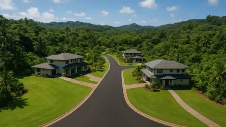

Large-scale residential developments consisting of twenty or more units would be required to provide a second county-standard access road to facilitate emergency evacuations. This proposed shift in the Kauaʻi County Building Code represents a significant pivot toward proactive disaster mitigation in one of the most geographically isolated regions of the United States. Recent environmental challenges across the islands have highlighted the lethal risks associated with “bottleneck” neighborhoods where a single entry point serves as the only viable exit during fast-moving wildfires or flash floods. By mandating redundant infrastructure, the county aims to eliminate the catastrophic delays that occur when primary routes are obstructed by fallen trees, downed power lines, or emergency vehicles moving in the opposite direction. This regulatory movement isn’t merely a local adjustment; it is a response to a global trend of increasing climate volatility and the urgent need for resilient urban planning that prioritizes human life.
Infrastructure Requirements: Resilience in Design
Implementing a secondary access requirement necessitates a radical rethink of how subdivisions are designed and integrated into the existing rural landscape of the island. Beyond just a simple dirt path, these roads must meet specific county standards for width, grade, and weight capacity to ensure that heavy fire apparatus can navigate them effectively. Engineers are now tasked with identifying terrain that allows for dual-point connectivity, which often complicates the development of hillside properties or coastal strips where space is at a premium. This shift moves away from the popular cul-de-sac model that dominated residential construction for decades, favoring instead a more permeable grid or loop system. Such designs not only enhance safety during a crisis but also improve daily traffic flow and neighborhood connectivity. However, the requirement for a second road can significantly increase the initial capital investment for developers, leading to intense debates regarding safety.
Modern GIS mapping and landscape modeling are playing a pivotal role in determining where these secondary access points can realistically be situated without causing undue environmental harm. In many areas of Kauaʻi, preserving native flora and managing storm runoff are equally critical concerns that must be balanced with the new road requirements. Planners are exploring the use of permeable paving materials and bioswales alongside these emergency routes to mitigate the heat island effect and manage drainage issues. This holistic approach ensures that while the community is safer from fire or flood, the local ecosystem is not sacrificed in the process of building defensive infrastructure. Furthermore, the code update encourages the use of automated gate systems that can be triggered remotely by emergency dispatchers, ensuring that secondary roads are accessible the moment they are needed. This integration creates a robust defense against unpredictable modern threats.
Regulatory Influence: Creating a Global Template
The potential for Kauaʻi’s building code to serve as a national model is rooted in its aggressive stance on developer responsibility and long-term risk management. Federal agencies, including FEMA and the Department of Housing and Urban Development, are closely monitoring the implementation of these standards as they look for ways to reduce future disaster recovery costs. When local jurisdictions enforce strict egress requirements, they essentially lower the risk profile of the entire community, which can eventually lead to more favorable insurance rates and increased federal grant opportunities for infrastructure. This top-down regulatory pressure encourages other coastal and fire-prone regions in California, Oregon, and Colorado to adopt similar measures, creating a more uniform standard for disaster-resilient housing. By shifting the burden of safety infrastructure from the taxpayer to the developer, the county ensures that new growth does not outpace the capacity of emergency services.
As this initiative moved from the planning stages to active enforcement, the emphasis shifted toward ensuring that these new roads remained functional over the long term. Local governments established recurring maintenance funds and rigorous inspection schedules to prevent emergency routes from falling into disrepair or being blocked by illegal parking and debris. Communities discovered that the most successful outcomes occurred when residents were actively involved in emergency drills and understood how to utilize the secondary access points effectively. Moving forward, urban planners prioritized the integration of these routes into larger regional transportation networks, ensuring that neighborhood-level safety measures complemented broader evacuation strategies. For other jurisdictions looking to emulate this success, the key takeaway was the necessity of early collaboration between fire marshals, civil engineers, and residents to ensure that life safety remained the top priority during development.