
The catastrophic seismic activity that tore through the coastal state of La Guaira on June 24 serves as a grim reminder of how fragile human engineering can be when faced with the raw, tectonic power of the Earth’s shifting plates. This double earthquake event transformed a bustling coastline into a landscape of rubble within minutes, prompting immediate investigations into the region’s geological vulnerabilities and the structural integrity of its modern buildings. Civil engineer José Gregorio Rengel, a leading expert in seismic risk, has spearheaded the analysis of this tragedy, focusing on the specific variables that converted a natural tremor into a humanitarian crisis. His findings suggest that while the magnitude was significant, the intersection of urban density and specific geological anomalies created a perfect storm of destruction. The urgency of this situation has forced a national conversation on whether existing safety protocols were sufficient or if the sheer violence of the event simply bypassed standard safeguards.
Understanding the Seismic Event and Immediate Response
Geological Catalysts: The Power of the San Sebastián Fault
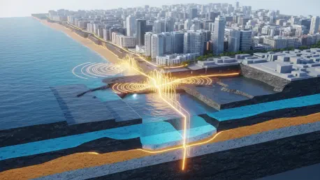
One of the most significant factors in the devastation was the localized proximity of the San Sebastián fault, which sits dangerously close to the population centers of La Guaira. Because the epicenter occurred at a remarkably shallow depth, the energy released had very little distance to dissipate before reaching the surface, resulting in an intense vertical and horizontal acceleration that pulverized brittle materials. In many neighborhoods, the rupture plane was located almost directly beneath residential structures, leaving no buffer zone for the seismic waves to lose momentum. This near-field phenomenon meant that buildings were subjected to ground motions far more violent than those typically recorded during tremors of similar magnitudes elsewhere. Engineering reports indicate that the velocity of the ground displacement effectively exceeded the structural elasticity of most mid-rise buildings, causing immediate shear failure in primary support columns.
Beyond the fault itself, the specific topography of the coastline acted as an amplifier for the seismic waves, creating a resonance effect that proved fatal for many older developments. The geological composition of the region, characterized by sediment-filled basins and steep mountainous backdrops, trapped the energy of the second tremor, causing it to bounce back and forth between the rock formations. This trapped energy significantly increased the duration of the shaking, which is often more damaging than the initial jolt because it fatigues reinforced concrete through repeated stress cycles. Civil protection data suggests that structures that survived the first hit were fundamentally weakened, making them unable to withstand the subsequent resonance of the secondary waves. This explains why certain areas showed complete collapse while neighboring streets remained partially standing, as the subterranean rock formations directed the seismic energy into concentrated pockets.
Rapid Damage Assessment: Technical Structural Audits
In the immediate aftermath, the regional government deployed an emergency technical response team to implement a specialized rapid inspection protocol known as the traffic-light system. This triage method allowed structural engineers to evaluate more than 32,000 individual properties in record time, assigning a color-coded status to each to guide the displaced population. Green tags indicated that a building suffered only cosmetic damage and was safe for immediate re-entry, while yellow tags marked structures that required more thorough investigation but remained stable for temporary access. The red tag, the most critical designation, signaled a complete loss of structural integrity, necessitating immediate evacuation and a strict perimeter to prevent injuries from potential collapse during aftershocks. This systematic approach was essential for managing the chaos, as it provided clear, data-driven instructions to families who were desperate to salvage belongings but unaware of hidden dangers.
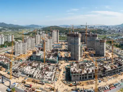
Following the initial categorization, the strategy shifted toward high-precision structural audits for all red and yellow-tagged properties to determine the feasibility of reconstruction. These technical evaluations involve the use of ultrasonic testing and core sampling to check the health of the internal steel reinforcement and the density of the concrete foundations. Engineers are now tasked with deciding whether a building’s skeletal frame can be retrofitted with modern dampers and shear walls or if the damage is so systemic that controlled demolition is the only safe option. This phase of the recovery is not just about clearing debris; it is a forensic exercise meant to uncover why specific designs failed while others held firm. By documenting these failures, the engineering community is building a repository of knowledge that will dictate the future of urban development in seismic zones. This detailed analysis ensures that the emotional desire for a quick recovery does not override the technical necessity for safety.
Infrastructure Analysis and Reconstruction Strategies
Comparative Analysis: Public and Private Structural Performance
The disaster in La Guaira effectively challenged several long-held assumptions regarding the relative safety of different types of housing developments across the state. Initial reports often speculated that low-income public housing projects, particularly those under the Great Venezuela Housing Mission, would be the most susceptible to seismic failure. However, the data collected from the impact zone revealed a much more complex reality where both high-end private condominiums and public apartment blocks suffered catastrophic collapses. The analysis showed that the intensity of the seismic forces in the near-field of the San Sebastián fault was so great that it bypassed the standard distinctions between construction budgets or project origins. This suggests that the failure was less about the socio-economic status of the residents and more about the extreme physical demands placed on every structure in the path of the rupture. Both sectors now face a reckoning as they must adapt to a new understanding of the forces.
Critically, the widespread damage occurred despite the fact that Venezuela possesses one of the most advanced sets of building regulations in the region, updated as recently as the 2019 COVENIN standards. These codes align with international best practices for seismic-resistant design, incorporating modern requirements for ductility and lateral load distribution. The failure of buildings that supposedly met these criteria indicates that the June earthquake produced ground motions that simply exceeded the theoretical maximums used for local design maps. Many structural engineers argue that the current codes are robust but may need revisions to account for the unique vertical accelerations experienced in coastal regions with shallow fault lines. The focus of current legislative reviews is to assess whether the 2019 standards should be treated as a baseline rather than a ceiling, especially for critical infrastructure. Strengthening these mandates will require a balance between economic feasibility and the uncompromising need for structural redundancy.
Future Resilience: The Role of Seismic Microzoning
The path toward a safer La Guaira hinges on the completion of comprehensive seismic microzoning, a scientific process that maps how specific neighborhoods respond to different frequencies of shaking. Unlike general seismic maps, microzoning takes into account the depth of the water table, the thickness of sediment layers, and the slope of the terrain to create high-resolution risk profiles. By integrating this data into the urban planning process, authorities can implement highly specific building requirements that vary from one street to the next based on soil behavior. For instance, areas with soft, sandy soils that are prone to liquefaction might require deep-pile foundations or be restricted to low-rise, lightweight structures. This approach represents a shift from reactive disaster management to proactive engineering, where the landscape itself dictates the parameters of human construction. Without this level of detail, reconstruction efforts risk repeating mistakes by placing vulnerable designs on foundations predisposed to amplify waves.
Ultimately, the reconstruction effort focused on establishing a culture of professional accountability that extended from the architect’s desk to the construction site. Engineers and government officials worked together to ensure that the scientific findings from the June earthquake were translated into mandatory technical protocols for every new project. These measures included the mandatory installation of seismic monitoring sensors in all new high-occupancy buildings to provide real-time data for emergency responses. Furthermore, the legal framework was strengthened to hold developers accountable for structural failures that were found to be the result of material negligence or deviations from existing building codes. This systemic overhaul transformed La Guaira into a laboratory for seismic resilience, where the lessons of the past became the blueprint for a more secure future. By prioritizing microzoning data, the state moved toward a model of development that respected the geological reality of its location and provided a clear path toward sustainable urban recovery.