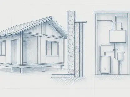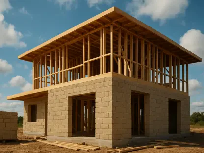

The traditional gap between a sophisticated architectural model and the messy reality of a dirt-filled construction site is rapidly closing as digital layout solutions redefine how structures are built from the ground up. Currently valued at approximately $2.8 billion in 2026, the global site layout software market is on a trajectory to more than double, reaching a projected $6.5 billion by the year 2036. This growth, characterized by a robust compound annual growth rate of 8.8 percent, reflects a profound industry-wide recognition that manual methods of setting out are no longer sufficient for the complexities of modern engineering. In an era where building designs feature increasingly intricate geometries and tight tolerances, the reliance on paper blueprints and manual string lines has given way to sophisticated software ecosystems. These platforms function as a critical bridge, ensuring that the “as-built” physical reality of a project remains in perfect alignment with the “as-designed” digital intent. By facilitating the seamless transfer of Building Information Modeling data to high-precision field instruments, this technology eliminates the ambiguity that has historically plagued the handoff from the design office to the construction crew. As the construction industry continues its broader digital transformation, site layout software stands as a primary catalyst for efficiency, accuracy, and safety on the jobsite.
Strategic Drivers: Innovation at the Core
Step 1: Streamlining the Model-to-Field Transition
The evolution of modern construction workflows hinges on the ability to move data from a controlled office environment to the dynamic conditions of a jobsite without losing critical information. Historically, the handoff between design and execution was a major bottleneck, often involving the manual transcription of coordinates from a digital file onto a physical list that workers would then use to stake out a site. This process was notoriously prone to human error, where a single mistyped digit could result in a foundation being poured several feet away from its intended location. Modern site layout software addresses this vulnerability by allowing field crews to import approved geometric data directly into their positioning instruments. This direct digital integration ensures that the field team is working with the most current version of the architectural model, effectively creating a single source of truth that spans the entire project lifecycle. By removing the need for manual data entry, contractors can drastically reduce the incidence of construction defects, ensuring that the physical structure perfectly mirrors the complex calculations of the engineers.
Furthermore, the streamlining of this transition has allowed for the adoption of architectural designs that were previously considered too difficult or expensive to execute. When layout was performed with tape measures and theodolites, non-linear geometries and complex curves required an immense amount of time and specialized expertise to set out accurately. Today, the software can effortlessly calculate and project these intricate paths onto the site, allowing for more creative and organic building shapes without a proportional increase in labor costs. This capability has democratized high-design architecture, making it feasible for standard commercial projects to incorporate sophisticated aesthetic elements that once were reserved for only the most prestigious builds. The ability to handle diverse file formats such as IFC, DXF, and DWG means that layout software acts as a universal translator, bridging the gaps between various design platforms and the physical world. This fluidity in data movement not only speeds up the initial phases of construction but also establishes a foundation of precision that benefits every subsequent trade working on the project.
Precision Engineering: The Role of Total Stations
The synergy between layout software and hardware, specifically robotic total stations, has fundamentally altered the labor dynamics of the modern construction site. In the past, the process of staking out a site required a multi-person crew consisting of a professional surveyor, a rod holder, and a note-taker to manually record and verify positions against paper drawings. However, modern site layout software allows a single operator to control a robotic total station via a handheld tablet or controller, using a prism pole to locate points with sub-centimeter accuracy. This shift effectively addresses the chronic labor shortages currently facing the construction sector by increasing the productivity of the existing workforce. The software provides the operator with an intuitive interface that guides them to the exact location of each point, providing real-time visual feedback that confirms when the prism is perfectly aligned with the digital model. This immediate verification loop prevents the compounding of errors that often occurs when manual measurements are taken over long distances or through complex, uneven terrain.
In addition to labor efficiency, the integration of software with high-precision hardware allows for a much higher frequency of quality control checks throughout the construction process. Rather than waiting for a formal survey to occur at the end of a project phase, layout software enables field teams to conduct “as-built” verifications in real-time. As components like steel columns or plumbing sleeves are installed, the operator can quickly check their location against the design model and record the actual position. If a discrepancy is found, the software can immediately highlight the deviation, allowing the team to make corrections before the next stage of construction begins. This proactive approach to quality assurance is a major factor in the market’s growth, as it prevents the extremely costly rework that occurs when errors are discovered after a building is substantially completed. The software also maintains a comprehensive digital log of every point measured, creating an immutable record of compliance that is invaluable for insurance purposes and long-term facility maintenance.
Technological Synergies: Redefining Field Operations
Immersive Visualization: Augmented Reality Integration
The integration of augmented reality with site layout software represents a leap forward in how field technicians interact with project data. By overlaying a three-dimensional digital model onto the actual physical environment through a tablet or specialized wearable headset, workers can see the future structure as if it were already built. This immersive visualization provides a level of spatial awareness that was previously impossible to achieve with traditional two-dimensional plans. A field supervisor can walk through a site and see exactly where a wall will be placed, where electrical conduits will run, and how mechanical systems will intersect, all before a single piece of material is ordered. This ability to “see through” the ground and walls helps to identify potential clashes and logistical hurdles early in the process. For instance, seeing a digital representation of underground utilities can prevent accidental strikes during excavation, significantly enhancing safety and avoiding the massive delays and expenses associated with utility damage.
Beyond safety and logistics, augmented reality within layout software serves as a powerful tool for stakeholder communication and client engagement. When a developer or owner visits the site, they no longer have to imagine the finished product based on abstract drawings or verbal descriptions. Instead, they can witness the building’s footprint and internal layout in the context of the surrounding landscape, which facilitates quicker decision-making and reduces the likelihood of change orders later in the process. This technology also assists in the training of less experienced field staff, as it provides a clear, visual context for the tasks they are performing. By making the digital model a tangible part of the physical jobsite, augmented reality reduces the cognitive load on workers and helps ensure that everyone on the team has a unified understanding of the project goals. As hardware becomes more affordable and software algorithms more robust, the use of immersive visualization is expected to become a standard component of site layout workflows across the globe.
Cloud Connectivity: Real-Time Data Management
The transition from localized software to cloud-based platforms has revolutionized the way construction data is managed and shared across disparate teams. In the current 2026 landscape, site layout software is no longer a siloed tool used only by the field crew; it is part of a dynamic, interconnected ecosystem that links the jobsite to the design office in real-time. When an architect makes a change to the structural model in the office, that update can be instantly pushed to the layout tablets in the field. This eliminates the risk of crews working off outdated plans, a problem that has historically been one of the primary causes of construction errors and waste. Conversely, data collected in the field can be synced back to the office immediately, providing project managers with up-to-the-minute progress reports and “as-built” data. This bidirectional flow of information enables a more agile approach to construction management, where decisions can be made based on accurate, real-time data rather than delayed reports from the field.
Furthermore, cloud-connected layout software facilitates better coordination between the various subcontractors working on a project. For example, the plumbing contractor can see the exact layout of the electrical conduits and structural elements, allowing them to adjust their own installation paths to avoid conflicts. This level of interdisciplinary coordination is essential for the high-density urban projects that are becoming increasingly common. The software acts as a collaborative platform where different trades can share their layout points and verify that their work is not infringing on the space allocated to others. This collaborative environment reduces the friction that often exists between subcontractors and fosters a more cooperative atmosphere on the jobsite. As project schedules become tighter and margins thinner, the efficiency gains provided by real-time data management are becoming a critical competitive advantage for firms looking to succeed in a rapidly evolving market.
Economic Implications: Waste Reduction and Cost Savings
Rework Mitigation: Accuracy as a Financial Asset
The financial burden of rework in the construction industry is staggering, with studies frequently indicating that up to 30 percent of total project costs can be attributed to correcting errors and deficiencies. Site layout software serves as a primary defense against these preventable costs by ensuring high-precision accuracy from the very beginning of the project. When the initial layout of a building is flawed, every subsequent task—from the foundation pour to the installation of mechanical systems—is built upon a faulty premise, leading to a cascade of expensive corrections. By using digital layout tools to verify the position of every structural element as it is installed, contractors can identify and rectify errors when they are still relatively easy and inexpensive to fix. The cost of moving a misplaced plumbing sleeve before the concrete is poured is negligible compared to the cost of core drilling through a structural slab after the fact.
Beyond the direct costs of labor and materials, rework also has a significant impact on project timelines and the associated overhead expenses. Every day spent correcting an error is a day that the project is not moving forward, which can lead to liquidated damages and increased financing costs for the developer. Site layout software helps maintain the project schedule by minimizing these delays and ensuring that work proceeds smoothly from one phase to the next. The confidence that comes with knowing the layout is accurate allows contractors to pre-fabricate more components offsite, which further speeds up the construction process and reduces onsite waste. As the industry moves toward more industrialized construction methods, the need for extreme precision in layout becomes even more critical. The ability to guarantee that components manufactured in a factory will fit perfectly when they arrive at the jobsite is a direct result of the high-fidelity data provided by modern site layout solutions.
Sustainability: Environmental Benefits of Digital Precision
While the economic benefits of site layout software are well-documented, its contribution to environmental sustainability is an increasingly important factor in its market adoption. The construction industry is a major consumer of natural resources and a significant generator of waste, much of which is caused by the very rework that digital layout tools are designed to prevent. By ensuring that materials like concrete and steel are placed correctly the first time, layout software helps to minimize the volume of wasted materials that end up in landfills. This precision is particularly important for high-performance buildings that require strict adherence to energy-efficient designs. If a building envelope is not constructed exactly as designed, its thermal performance can be compromised, leading to higher energy consumption throughout the lifecycle of the structure. Site layout software ensures that the physical building achieves the sustainability goals set during the design phase.
In addition to waste reduction, the use of digital layout tools can also minimize the environmental impact of the construction site itself. Modern software allows for a more surgical approach to excavation and site preparation, reducing the amount of soil that needs to be moved and minimizing the disturbance to the local ecosystem. By optimizing the paths for utility lines and infrastructure, contractors can reduce the total length of trenching required, which saves fuel and reduces the carbon footprint of the heavy machinery used on site. Furthermore, the integration of layout software with digital twins and lifecycle management tools allows for better resource management long after the construction phase is complete. When a facility manager has an accurate digital record of exactly where every asset is located, they can perform maintenance and repairs more efficiently, extending the life of the building and reducing the need for premature replacements. This long-term view of sustainability is becoming a key driver for owners and developers who are increasingly focused on the total environmental impact of their investments.
Strategic Implementation: Insights for the Future
Global Adoption: Expanding into Emerging Economies
The expansion of the site layout software market is not limited to the established construction sectors of North America and Europe; it is increasingly becoming a global phenomenon driven by massive infrastructure investments in emerging economies. In regions like Southeast Asia, Africa, and parts of Latin America, rapid urbanization is fueling a demand for high-quality, large-scale infrastructure that can be delivered quickly and accurately. These markets are often skipping the traditional manual methods of construction and moving directly to digital-first workflows, as they seek to leverage the latest technology to meet their development goals. The adoption of site layout software in these regions is also being supported by government mandates for the use of Building Information Modeling on public works projects. These policies are designed to improve transparency, reduce corruption, and ensure that public funds are used as efficiently as possible, all of which are bolstered by the precise record-keeping capabilities of digital layout tools.
Furthermore, the global nature of the construction software industry means that innovations developed in one part of the world can be rapidly deployed in others. Cloud connectivity allows firms to manage projects across different continents, using a unified platform to coordinate with international design teams and local field crews. This global connectivity is fostering a more standardized approach to construction layout, where best practices and data protocols are shared across borders. The challenge for software providers in this expanding market is to ensure that their tools are adaptable to local conditions, such as varying levels of internet connectivity and different linguistic and regulatory requirements. Companies that can provide localized support and intuitive user interfaces while maintaining the high-precision capabilities required by modern engineering will be best positioned to capture a share of the burgeoning global demand. The ongoing investment in global telecommunications infrastructure, including the deployment of low-earth-orbit satellite internet, will further facilitate the use of cloud-connected layout software in even the most remote construction sites.
Actionable Success: Lessons from Market Leaders
The industry discovered that the most successful firms were those that treated software adoption not as a one-time purchase, but as a cultural evolution within the organization. These industry leaders invested heavily in cross-training their field crews, ensuring that the technicians on the ground possessed a deep understanding of the digital models they were implementing rather than just knowing which buttons to press. It became evident that when field feedback was integrated back into the original design files through the software’s reporting features, the resulting digital twins were far more accurate and useful for long-term facility management. Stakeholders who prioritized this bidirectional data flow saw a marked decrease in the overall duration of the project lifecycle and a significant reduction in litigation related to construction defects. Furthermore, the early adoption of standardized data protocols proved to be a decisive factor in maintaining interoperability between various subcontractors, which simplified the resolution of complex structural disputes and improved overall site morale.
Strategic leaders also recognized that the path to a robust market presence was paved by a commitment to data integrity and environmental responsibility. Companies moved toward a model where every layout point was tracked and logged, providing an immutable audit trail for quality assurance and regulatory compliance. This focus on transparency not only improved client relations but also led to reduced insurance premiums as the systemic risks associated with major structural failures were mitigated by rigorous digital verification. In retrospect, the most effective next steps involved the decentralization of data access, allowing every stakeholder from the lead architect to the plumbing contractor to work from a synchronized, live version of the site plan. The lessons learned during this period of rapid expansion established a new baseline for global construction standards, where digital layout was no longer viewed as an optional luxury but as a fundamental requirement for any large-scale infrastructure endeavor. Moving forward, the focus shifted from simple coordinate placement to comprehensive asset lifecycle management, where the initial layout data served as the foundation for the entire life of the building.