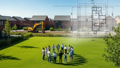

The quiet suburban landscape of Grimsby has recently become the center of a profound debate regarding the sanctity of communal land versus the urgent pressure for residential expansion. For nearly five decades, a modest plot of greenery nestled between Ashby Close and Glenfield Road served as an informal sanctuary where children learned to ride bicycles and neighbors gathered for leisure, yet this continuity was nearly severed by a proposal for high-density housing. When developers sought to transform this legacy into a set of four-bedroom homes, they inadvertently ignited a grassroots movement that questioned whether historical usage rights could supersede modern ownership titles. The resulting standoff between Rameco Ltd and the local population illustrates a growing national tension where the quantifiable need for new housing inventory directly clashes with the intangible value of established neighborhood assets. This conflict reveals the complexities inherent in urban planning during an era where every square foot of soil is contested and requires a more nuanced approach than simple zoning maps provide.
The Intersection of Development and Community Identity
Historical Utility: The Value of Informal Public Parks
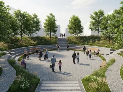
The specific plot of land within The Willows neighborhood represents more than just an empty lot; it has functioned as a central hub for social cohesion and physical activity since the late twentieth century. Residents argued during the planning sessions that the area was originally designated for recreational use when the neighborhood was first conceived, establishing a long-term expectation of public access that spanned multiple generations. This historical precedent was backed by significant local support, including a petition featuring hundreds of signatures and formal objections from educational leaders at Wybers Wood Primary School. The headteacher confirmed that the site is a vital resource for students, offering a safe environment away from traffic where children can engage in unstructured play. This perspective suggests that the value of such spaces cannot be measured solely by the potential revenue of new construction but must include the social health and safety benefits provided to the youngest members of the community.
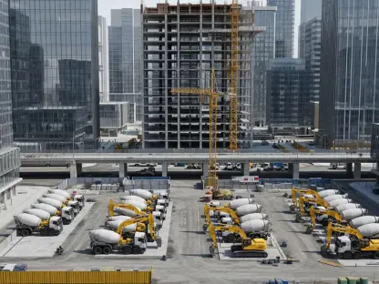
On the opposing side of the debate, the developers positioned their project as a necessary and sustainable contribution to the local housing market, which is currently facing increased demand for family-sized dwellings. They argued that the construction of four-bedroom houses would utilize underperforming land to provide high-quality homes in a location already served by existing infrastructure. To address concerns regarding pedestrian access and safety, the development firm proposed several mitigations, such as the inclusion of a dedicated three-meter-wide footpath and new traffic regulation orders to manage the flow of vehicles around the site. From a purely economic and administrative standpoint, the project aligned with broader urban intensification goals that seek to maximize the utility of available urban space. However, these technical justifications often struggle to gain traction when they are perceived as threats to the established character of a neighborhood that has remained largely unchanged for nearly half a century.
Urban Intensification: Balancing Growth and Open Space
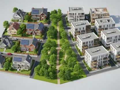
The planning committee’s deliberation focused heavily on the concept of over-intensification, a term used to describe when a development proposal attempts to fit too much infrastructure into a restricted area. Members of the committee observed that the proposed four-bedroom houses were fundamentally out of character with the surrounding spatial layout, potentially creating a cramped environment that would diminish the quality of life for both new and existing residents. This concern highlighted a critical tension in modern urban design: the push to maximize housing density can sometimes lead to the erosion of the very amenities that make a neighborhood desirable in the first place. By rejecting the proposal, the committee signaled that the preservation of the existing neighborhood fabric was a higher priority than the marginal increase in housing stock. This decision underscores the necessity for developers to propose projects that respect the aesthetic and functional rhythms of established residential zones.
Furthermore, the rejection emphasized that sustainable development must be holistic, accounting for environmental and psychological factors alongside economic metrics. Local councilors emphasized that building on well-used amenity spaces was a strategic error that could lead to long-term community dissatisfaction and a loss of public trust. The focus remained on the fact that once these informal green spaces are lost to concrete and brick, they are almost never recovered, representing a permanent shift in the local ecosystem. While the developer attempted to bridge the gap by offering improved footpaths, the committee viewed these as insufficient replacements for the loss of an open, flexible area. This suggests that for developers to be successful in the current climate, they must find ways to integrate their projects into the existing community landscape rather than displacing the assets that residents value most.
Legal Frameworks and Governance Challenges
Transparency: Challenges in Local Land Disposal
A significant point of contention emerged regarding the transparency of the local government’s actions during the initial sale of the land. In the years leading up to the current dispute, specifically starting around 2023, the council made the decision to dispose of the property, a move that many local residents claim happened without adequate public notification or consultation. This perceived lack of transparency fueled a sense of betrayal among the community, who felt that a public asset had been liquidated behind closed doors for private gain. The legal status of the land became a central theme in the planning committee’s deliberations, as legal advisors noted that the site technically lost its official designation as a “public open space” the moment the sale was finalized. This transition created a difficult situation where the de jure status of the property as private land stood in direct opposition to its de facto use as a communal park.
Despite the clear legal shift in ownership, the North East Lincolnshire Council’s planning committee chose to prioritize the functional and social reality of the site over its formal classification. Committee members expressed deep skepticism regarding the suitability of the proposed development, characterizing the plan as an over-intensification of a confined area that would be fundamentally out of character with the surrounding environment. This decision was influenced by the ongoing efforts of residents to secure a public right-of-way, an initiative supported by local councilors who viewed the land as an irreplaceable amenity space. The unanimous refusal of the planning application sent a strong signal that legal technicalities regarding land titles do not always grant developers a mandate to ignore the established usage patterns of a community. It underscored the reality that land value is a multi-dimensional concept where social utility often outweighs immediate economic benefits.
Strategic Planning: Future Proofing Community Assets
The conflict highlighted the need for a more robust framework for identifying and protecting land that, while technically available for development, serves a vital role in the social infrastructure of a town. Planning experts suggested that municipalities should conduct more frequent audits of informal green spaces to ensure their value is recorded before developers express interest in them. By formalizing the status of these “hidden” parks, councils can avoid the legal and social friction that occurs when residents discover their favorite local spots are being sold. This proactive approach would provide much-needed clarity for developers, who would be less likely to invest resources into projects that face overwhelming community and political opposition. Creating a transparent map of community-valued assets would streamline the development process and ensure that growth occurs in areas where it is truly welcomed and needed.
Moreover, the case demonstrated that successful urban growth requires a collaborative relationship between the public sector, private developers, and the local population. When developers engage with residents early in the design phase, they can often identify potential points of conflict and adjust their plans to include the very amenities the community fears losing. In this instance, the lack of early engagement led to a defensive stance from the neighborhood, which ultimately resulted in the total rejection of the project. Future developments in similar suburban contexts will likely require more innovative design solutions, such as mixed-use spaces that combine residential units with protected public parks. This balanced strategy would allow for the necessary expansion of the housing market while simultaneously enhancing the recreational resources available to the public, turning potential conflicts into opportunities for neighborhood improvement.
Strengthening Local Planning Outcomes
The resolution of the dispute in Grimsby provided a critical precedent for how municipalities might navigate the delicate balance between urban density and the preservation of green spaces. Moving forward, local authorities recognized that maintaining an updated and transparent registry of communal assets was essential to preventing similar conflicts in the future. They sought to implement more rigorous public consultation phases before any council-owned land was offered for sale, ensuring that the community’s historical connection to the land was formally evaluated. Planning boards began to weigh the long-term mental and physical health benefits of informal parks against the temporary economic gains of residential construction. Residents and developers alike were encouraged to engage in collaborative design processes that integrated shared green spaces into new housing plans rather than treating them as mutually exclusive options. This shift in strategy aimed to create more resilient neighborhoods where development respected the established social fabric while meeting population needs.