
The technical design phase scheduled for 2026 will produce the construction documents required to transform the city’s vision into a physical reality for visitors. This momentous shift represents a definitive turning point for Columbia, as the municipal government moves forward with a master plan that covers nearly one hundred acres of underutilized land nestled between the Blossom Street and Gervais Street bridges. For decades, this prime real estate remained largely disconnected from the daily lives of residents, serving as a silent witness to the city’s growth rather than an active participant in its urban fabric. The current initiative seeks to bridge the gap between existing landmarks like Riverfront Park and Granby Park, effectively stitching together the disparate threads of the local landscape into a cohesive recreation corridor. By establishing this vital link, the city is positioning itself as the epicenter of a massive twenty-seven-mile regional greenway system. This network is not merely about aesthetic improvement; it is a fundamental reconfiguration of how the urban core interacts with the natural environment, ensuring that the rivers once again serve as the lifeblood of the community’s social and recreational activities.
Immediate Infrastructure: Breaking Ground on Williams Street
The initial physical manifestation of this sweeping vision begins with the revitalization of Williams Street, which is designed to serve as the principal gateway into the heart of the new riverfront district. Scheduled to commence as early as January, this phase focuses on transforming a standard thoroughfare into an inviting entrance that beckons visitors toward the water’s edge. A key feature of this early construction is a scenic overlook that will provide residents with panoramic views of the Congaree, offering an immediate sense of place and purpose. Funding for this specific infrastructure work has already been secured through a strategic combination of state-level allocations and resources from the Richland Penny program. By prioritizing this entrance, the city ensures that the momentum generated during the planning stages translates into tangible progress that the public can witness firsthand. This approach allows for a phased rollout of the larger master plan, ensuring that every dollar spent contributes to a durable foundation for future development while providing immediate utility to the surrounding neighborhoods.
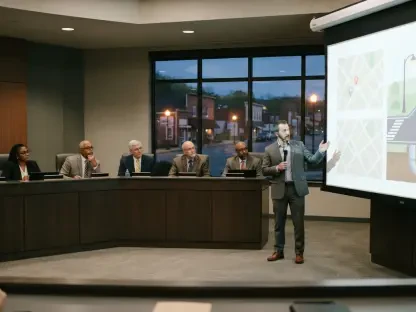
Once the overarching master plan receives its formal legislative approval from the City Council in early January, the administration will dedicate the remainder of the year to finalizing the complex engineering requirements necessary for the full park buildout. This technical period involves a deep collaboration with landscape architecture firms like Field Operations to ensure that every environmental and structural detail aligns with the community’s high expectations. The transition from conceptual renderings to precise construction blueprints is a meticulous process that accounts for everything from soil stability and flood mitigation to the integration of sustainable materials. While the overarching vision is grand, the success of the riverfront district hinges on these granular technicalities. By spending the next twelve months refining these documents, the city avoids the pitfalls of rushed execution, ensuring that the eventual physical structures are resilient enough to withstand the elements while maintaining their aesthetic integrity. This phase is critical for translating the community’s abstract desires into a feasible, long-term asset that will serve generations.
Environmental Stewardship: Balancing Nature and Development
A central pillar of the current redevelopment strategy is the delicate balance between introducing modern amenities and preserving the inherent natural character of the Congaree River. Throughout the public engagement process, a recurring theme emerged among residents who were wary of excessive commercialization or overdevelopment that might strip the area of its rugged, scenic charm. The master plan addresses these concerns by prioritizing the conservation of existing green space and utilizing landscaping techniques that complement the native ecosystem. Instead of imposing a rigid urban grid onto the riverfront, the design follows the natural contours of the land, creating a space that feels both curated and wild. This commitment to environmental stewardship ensures that the river remains the primary attraction, with man-made structures serving as supportive elements rather than dominant features. By fostering this sense of organic integration, the city is creating a destination that appeals to outdoor enthusiasts and urban explorers alike, proving that progress does not have to be destructive.
To ensure the long-term viability of the district, the city has adopted a forward-thinking financial model that encourages private development along the perimeter of the park. This strategy is designed to create a self-sustaining ecosystem where property tax revenues generated by new residential and commercial projects fund the ongoing maintenance and operations of the public green spaces. By inviting private investment, the municipal government reduces the direct financial burden on local taxpayers while simultaneously stimulating economic growth in the downtown core. This approach transforms the riverfront from a potential liability into a robust economic engine that supports its own upkeep. The synergy between public recreation and private enterprise is intended to attract a diverse range of businesses, from waterfront cafes to boutique retail, all of which will benefit from the high foot traffic generated by the park. This model represents a modern approach to urban management, where the success of public assets is directly tied to the prosperity of the community.
Collaborative Governance: Managing Safety and Strategic Growth
The financial architecture supporting the Congaree Riverfront District is a testament to the power of collaborative partnerships between public and private entities. Rather than relying on a singular funding source, the project draws from a diverse pool of resources, including state-level infrastructure grants, county-wide programs, and significant contributions from the University of South Carolina. The involvement of the USC Foundation and the Boyd Foundation has been particularly instrumental, providing not only capital but also land donations that have expanded the project’s potential footprint. These partnerships allow the city to leverage external expertise and resources, ensuring that the master plan is executed with a level of sophistication and scale that would be impossible to achieve in isolation. By aligning the interests of academic institutions, private foundations, and government agencies, Columbia has created a unified front that is dedicated to the long-term success of the riverfront, demonstrating how shared goals can bridge gaps.
The implementation of the Congaree Riverfront District master plan established a clear trajectory for Columbia’s evolution into a modern, river-centric metropolis. By prioritizing immediate infrastructure wins like the Williams Street gateway, the city demonstrated the efficacy of a phased development approach that maintained public enthusiasm while tackling complex technical requirements. The collaborative funding model successfully integrated private interests with public goals, proving that environmental conservation and economic growth were not mutually exclusive objectives. Looking ahead, the focus shifted toward the long-term management of these assets, emphasizing that the true value of urban renewal lay in the sustained quality of the visitor experience. Future urban planners learned from this initiative that transparency in the technical design phase and a commitment to multi-agency security were essential for the longevity of large-scale systems. As the city transitioned into this new era, the emphasis remained on refining the interaction between human activity and the landscape.