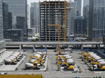

Pressure on rental markets had overtaken wage growth and vacancy rates, forcing cities to consider tools that bypass the slow churn of private development and unlock space where infrastructure already existed but lay underused or fenced off. Vernon’s planning department sharpened that lens this week, urging the mayor to secure meetings with British Columbia and federal officials to align two levers at once: public land for non-market housing, and a scaled reclaimed water program that could take pressure off potable supplies as new projects come online. The framing was unvarnished. Non-market housing, backed by the city’s Non-Market Housing Land Task Force (NHLTF), addressed affordable gaps the private market had not closed. Meanwhile, recycled water—long proven for irrigation—offered a pragmatic way to pair homes, parks, and civic landscapes with a dependable, lower-cost supply that preserved drinking water for household and health care needs.
The Case for Coordinated Public Land
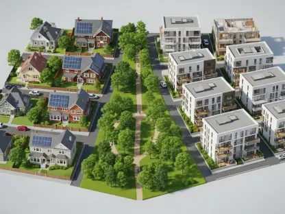
Non-Market Housing on Government Parcels
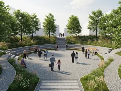
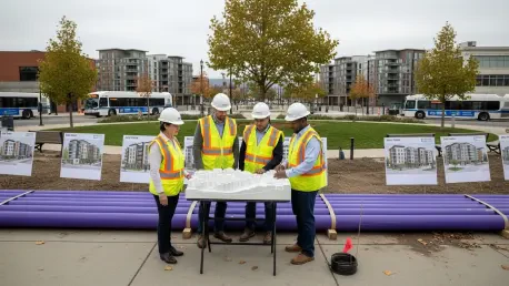
City staff outlined a shortlist of government sites where development could proceed if agencies agreed to reorganize land use and move quickly on due diligence. Justice Park, a provincially maintained downtown greenspace, emerged as a testbed for a hybrid model: modestly scaled housing at the perimeter, a reprogrammed green core, and a streetscape that preserved sightlines and tree canopy. Three federally connected locations advanced in parallel. The DND North lands near Highway 97 and Mission Road offered proximity to transit and employment, easing transportation costs for lower-income tenants. A Clerke Road parcel sat inside the Agricultural Land Reserve, raising the bar for approvals but not eliminating potential for purpose-built rentals if agricultural functions and setbacks could be protected through site planning and shared servicing.
The Brigadier Murphy Armoury on Hospital Hill, listed as a Federal Heritage Building and flagged in the 2024 federal budget as possible surplus, presented a different calculus. Heritage status imposed guardrails, but adaptive reuse—upper floors transitioned to supportive housing, drill halls converted to community space, compatible infill at the edges—had precedents in cities that balanced conservation with social outcomes. The NHLTF recommended a single negotiation track with Ottawa that bundled land disposition, heritage conservation protocols, and capital contributions from national housing programs into one term sheet. That bundling could shorten timelines by aligning environmental reviews, servicing plans, and funding approvals, instead of treating them as separate hurdles. Staff emphasized that early clarity on parcel boundaries, rights-of-way, and covenants would let the city stage projects to match contractor capacity and infrastructure upgrades.
Implementation Pathways and Intergovernmental Levers
Turning policy into keys-in-doors required choreography with Victoria and Ottawa on ownership, tenure, and operating subsidies. Staff proposed starting with site access agreements to conduct surveys, geotechnical work, and utility locates, followed by conditional commitments that tied land transfer or long-term leases to delivery milestones. Leasing public land at nominal rates, common in social housing, could erase a large share of pro forma costs and make deeper affordability feasible without overreliance on grants. The city’s approach foregrounded partnerships with community housing providers that had track records on complex care, Indigenous-led models, and family rentals, building a portfolio that spread risk while ensuring wraparound services where needed. By sequencing Justice Park and one DND site first, the city could apply lessons to later phases and avoid compounding delays.
Regulatory pathways would need tailoring per site. The Armoury’s heritage overlays required federal coordination and clear standards for reversibility, materials, and massing. The ALR parcel on Clerke Road necessitated an application to the Agricultural Land Commission, paired with agricultural enhancement measures such as on-site farm servicing, off-site offsets, or contractual farming arrangements that preserved productive capacity. To keep public trust, staff argued for transparent trade-off mapping: a matrix that showed gains in affordability and infrastructure efficiency against losses in unprogrammed green space, and how design would mitigate them. Bundling the city’s land request with a utilities plan and commitments to maintain or improve park function aimed to demonstrate net community benefit, a key test for provincial and federal decision-makers.
Water Reuse as Urban Infrastructure
Irrigation Strategy and Environmental Safeguards
In parallel, planners proposed scaling reclaimed water for irrigation across large public and quasi-public landscapes, reducing reliance on potable sources as neighborhoods densified. Two underused DND parcels, totaling about 200 acres, were vetted as suitable receiving sites with low environmental risk, based on soil infiltration capacity, distance from sensitive waterways, and existing distribution corridors. Routing tertiary-treated effluent to these lands could stabilize summer peak demand and harden the city against drought cycles without expensive new reservoirs. The design brief prioritized dual plumbing where feasible, pressure management to prevent cross-connection, and real-time monitoring of chlorine residuals and turbidity to keep performance within provincial guidelines. By focusing on irrigation rather than direct non-potable indoor uses, the program stayed within a well-understood regulatory lane and limited public health concerns.
The proposal did not ignore vulnerabilities. Climate variability could narrow irrigation windows, and salt accumulation or nutrient loading had to be tracked. Staff recommended phased commissioning with lysimeter testing, periodic soil sampling for salinity and micronutrients, and adaptive scheduling that rotated fields to avoid over-saturation. Distribution lines would follow utility corridors that already carried fiber or power, cutting construction conflict and enabling sensor backhaul for telemetry. Financially, the city pointed to lifecycle savings: lower chemical and pumping costs for the drinking system, deferred capital on wells, and predictable irrigation supply for public lands. The narrative stressed co-benefits—cooler microclimates, protected tree canopy, and resilient sports fields that remained playable during heat waves—framed as service outcomes rather than technical upgrades, supporting broader community buy-in.
Aligning Funding, Phasing, and Public Communication
This approach naturally led to a budget strategy that matched housing timelines with reclaimed water buildout. As non-market projects advanced on Justice Park or federal parcels, adjacent corridors could be outfitted with purple-pipe stubs and valve boxes, setting the stage for landscape irrigation upon occupancy rather than as an afterthought. Staff urged the mayor to seek combined funding envelopes—housing capital, heritage conservation support, and green infrastructure grants—so that trenching happened once, permitting ran in parallel, and accountability sat with a single intergovernmental table. To strengthen the case, the city prepared scenario analyses showing potable demand curves with and without reuse, and how savings scaled when multiple sites connected sequentially rather than piecemeal.
Public communication remained integral. Officials proposed neighborhood workshops that visualized park redesigns at Justice Park, explained ALR protections at Clerke Road, and demystified the reclaimed water process with straightforward quality thresholds instead of jargon. Independent peer reviews by water reuse experts and heritage architects would be published, giving residents and decision-makers confidence in risk management. By front-loading transparency on constraints—heritage limits, ALR rules, and the need to preserve urban green functions—the city signaled that trade-offs would be explicit, mitigations measurable, and benefits distributed. The result aimed for a program that was not only fundable and buildable, but also legible to the public that would live with its outcomes.
What Success Looked Like Next
Building on this foundation, the next phase depended on targeted outreach and disciplined sequencing. The mayor’s office was advised to request joint meetings with the Ministry of Housing, the Agricultural Land Commission, the Department of National Defence, and Public Services and Procurement Canada, using a single briefing binder that tied land transfers, heritage pathways, and reuse infrastructure to clear affordability targets. Early actions included securing site access letters, commissioning boundary and title reviews, and launching soil and water baseline tests at candidate irrigation fields. Procurement would favor design-build teams experienced in heritage retrofits and municipal reuse systems, reducing interface risk between disciplines. If those steps proceeded on schedule, shovel-ready packages could be positioned for intake windows that opened later this budget cycle, keeping momentum while safeguarding design quality and environmental performance.