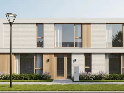

The disconnect between Cleveland’s premier cultural institutions and the residents living just blocks away has reached a critical turning point that demands a fundamental redesign of the city’s urban fabric. University Circle, often celebrated as Cleveland’s “second downtown,” currently exists as a prestigious but fragmented landscape where world-class hospitals and museums are separated by asphalt barriers and high-speed transit corridors. To address these systemic issues, the nonprofit University Circle, Inc. (UCI) has launched the “Connecting the Circle” master plan, a strategic initiative that serves as a visionary roadmap for overhauling the public realm and land-use policies. This ambitious proposal signals a departure from the historical focus on institutional expansion and land acquisition that defined the area for decades. By pivoting toward a philosophy of “place management,” the organization is now prioritizing the human experience, focusing on the pillars of people, place, and story to ensure that the district functions as a cohesive neighborhood rather than a series of isolated ivory towers. Through the utilization of a Special Improvement District, UCI aims to pool collective resources to enhance safety, aesthetics, and social connectivity, creating an environment that welcomes diverse visitors and long-term residents with the same level of care and consideration afforded to the major medical and educational giants that anchor the district.
Reimagining Infrastructure and Public Safety
Addressing Transportation Hazards and Connectivity
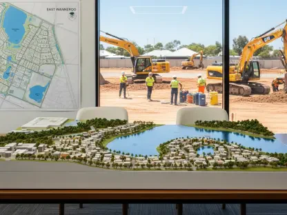
The urgency of this transformation is underscored by a sobering reality: the existing infrastructure in University Circle is fundamentally dangerous for anyone not traveling in a motorized vehicle. Detailed safety data analyzed over the previous years reveals a distressing pattern of over 200 crashes involving pedestrians and cyclists, with several incidents resulting in tragic fatalities and permanent injuries. Planners have identified specific “spaghetti tangles” of traffic that act as formidable physical walls, most notably at the complex intersection where Cedar Avenue, Martin Luther King Jr. Drive, and Stearns Road converge. At this specific location, 16 lanes of traffic meet in a confusing arrangement that prioritizes vehicle throughput over human safety, effectively stranding pedestrians and making the district feel hostile to those with limited mobility. The master plan proposes a radical simplification of these transit patterns, advocating for a transition from a car-first mentality to a human-centric model that views streets as public spaces rather than just conduits for commuters. By reclaiming asphalt for the community, the initiative seeks to dismantle the psychological and physical barriers that have long marginalized the pedestrians who live and work within the Circle’s boundaries.
To rectify these long-standing hazards, the “Connecting the Circle” initiative introduces several “Signature Moves” designed to transform major transit spines into vibrant, safe corridors. The plan envisions a dramatic overhaul of Euclid Avenue and East 105th Street, shifting the focus toward heavy landscaping, significantly widened sidewalks, and the installation of protected bike lanes that offer physical separation from traffic. Perhaps the most daring proposal involves the complete closure of Stearns Road to through-traffic, which would allow for a massive expansion of South Rockefeller Park. This move would transform what is currently a congested and underutilized traffic median into a functional, lush green space that serves students, healthcare workers, and local residents alike. By narrowing overly wide lanes and introducing traffic-calming measures, the plan aims to reduce vehicle speeds and create a more predictable environment for all road users. These structural changes are not merely aesthetic; they represent a fundamental commitment to public health and urban equity, ensuring that the district’s infrastructure supports the daily lives of the 70,000 employees and 6,500 residents who navigate these streets every day.
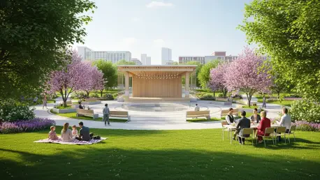
Enhancing the Civic Commons and Seasonal Vitality
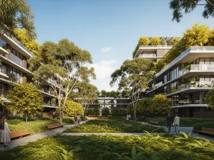
Central to the district’s social fabric is Wade Oval, often referred to as the “central park” of University Circle, yet it currently lacks the infrastructure to support consistent engagement outside of major summer events. The master plan seeks to elevate this space into a true “Connected Civic Commons” by introducing upgrades that encourage year-round activity and social interaction. Proposed improvements include the construction of a formal, permanent concert stage equipped with modern restroom facilities, which would eliminate the need for temporary setups and provide a consistent venue for local performers. To combat the seasonal lull during Cleveland’s colder months, the plan outlines a “winterization” strategy that features the installation of outdoor skating rinks, fire pits, and spaces for seasonal markets. These additions are intended to transform Wade Oval from a passive green space into a dynamic hub of community life, ensuring that the heart of the district remains vibrant and welcoming regardless of the weather. This focus on year-round vitality is a key component of UCI’s broader strategy to transition from a sterile institutional zone into a lived-in, walkable urban neighborhood that offers value to the public in every season.
Beyond the major park spaces, the master plan addresses the “psychological safety” of the district by targeting the dark and imposing gateways that currently mark the entrances to the Circle. Freight and transit rail bridges on Mayfield Road and Euclid Avenue have long acted as bleak, uninviting underpasses that discourage pedestrian movement and create a sense of isolation. The initiative proposes a series of artistic interventions and lighting upgrades to brighten these spaces, turning what were once perceived as dangerous gaps in the urban fabric into vibrant landmarks. By using colorful, high-quality lighting and public art installations, the plan aims to improve visibility and create a sense of continuity between University Circle and the neighboring communities. These improvements are designed to make the transition into the district feel safer and more intuitive, removing the “under-the-bridge” stigma that has historically acted as a barrier to exploration. By focusing on these often-overlooked elements of the public realm, the plan ensures that the district’s connectivity is as much about the quality of the journey as it is about the final destination.
Reckoning with History and Social Impact
Honoring Black History and Cultural Landmarks
A defining characteristic of the “Connecting the Circle” vision is its transparent and sincere reckoning with the district’s complicated history regarding its Black residents and business owners. For decades, the expansion of the Circle’s major institutions was synonymous with urban renewal projects that frequently displaced thriving Black neighborhoods and erased significant cultural landmarks. The master plan acknowledges this legacy and seeks to move beyond simple apologies by integrating these lost stories directly into the physical landscape. One of the most poignant examples is the proposed memorialization of the “Jazz Temple” at the corner of Euclid and Mayfield. Once a legendary venue that hosted icons like Miles Davis and John Coltrane, the club was destroyed by a bombing in 1965—an event that was never fully investigated and which left a void in the community’s cultural heritage. By using historical markers, public art, and digital storytelling, the plan intends to honor the sites of such erased history, ensuring that the contributions of the Black community are recognized as foundational to the identity of University Circle rather than being relegated to a forgotten past.
In addition to site-specific memorials, the plan emphasizes the restoration and enhancement of the Harrison Dillard Trail as a vital commemorative corridor. Named after the four-time Olympic gold medalist and Cleveland native, the trail is currently a 3.7-mile bikeway that is poorly marked and difficult for many to navigate effectively. The visionary plan aims to transform this trail into a high-quality, continuous pathway that not only provides a safe transit route but also serves as a narrative journey connecting the Circle to the historic Cleveland Cultural Gardens and the Lake Erie waterfront. By investing in the trail’s visibility and accessibility, the initiative creates a physical link between the institutional core and the broader story of Cleveland’s diverse heritage. This effort represents a shift toward inclusive urbanism, where the public realm is used as a tool for social restoration. By prioritizing these historical connections, the plan ensures that the district’s future growth is rooted in a deep respect for the people and cultures that were historically marginalized during the area’s institutional rise, fostering a more genuine sense of belonging for all Clevelanders.
Driving Economic Growth through Community Engagement
The development of the “Connecting the Circle” plan was a rigorous 15-month collaborative process that intentionally sought out the voices of those who live and work in the shadow of the district’s grand institutions. Funded by a $750,000 investment from the State of Ohio and the Holden Parks Trust, the planning phase included over a dozen major public events and generated nearly a thousand individual comments from community members. This high level of engagement was essential given the massive economic stakes involved; since 2005, the district has seen a staggering $7 billion in investment, making it one of the most significant economic engines in the Great Lakes region. The plan serves as a safeguard for this investment by ensuring that the area remains competitive and attractive to the top-tier talent required by the hospitals and universities. By shifting away from a sterile, “campus-only” environment toward a vibrant, mixed-use urban neighborhood, University Circle can better retain the 70,000 employees who represent the backbone of the local economy.
Ultimately, the overarching trend presented in this proposal is a definitive move toward human-centric urbanism, where the “car-first” mentality of the mid-20th century is replaced by a commitment to social and physical connectivity. There is a broad consensus among city planners, UCI leadership, and the public that the Circle cannot truly thrive if it remains an isolated island of wealth and prestige surrounded by disconnected neighborhoods. The plan argues that true economic resilience is tied to how well the district integrates with its surrounding environment. By balancing high-level traffic engineering and landscape architecture with a sensitive historical reckoning, the initiative aims to create a district that is not only a global destination but also a local asset. This approach ensures that the billions of dollars of institutional investment translate into tangible benefits for the public realm, resulting in a safer, more equitable, and more prosperous Cleveland. The success of this vision depends on a continued partnership between institutions and residents, moving together toward a future where University Circle is defined by its open doors rather than its barriers.
The presentation of the plan to the city’s Central East Design Review Committee and the Planning Commission marked a decisive step toward formal adoption. Once the vision was approved, the focus shifted to securing the necessary funding for the most complex infrastructure changes, such as the realignment of Martin Luther King Jr. Drive. Stakeholders recognized that the process was not merely about construction, but about rebuilding trust and ensuring that the public realm reflected the diverse identity of the city. By prioritizing immediate safety interventions alongside long-term cultural restorations, the district established a model for inclusive urban growth. This transition required University Circle, Inc. to evolve from a land-acquisition entity into an advocacy-based organization that represents the collective interests of the entire community. Future developments should continue to leverage the Harrison Dillard Trail as a bridge between neighborhoods, ensuring that the momentum from this master plan leads to sustained improvements in accessibility. Moving forward, the district must maintain its commitment to transparency and community-led design to ensure that University Circle remains a premier destination that honors its past while embracing a more connected future.