
The demand for efficient and sustainable construction has never been greater; major cities in the United States are experiencing a dense urbanization crisis, covering an estimated 83% of the land. This puts city planning and construction in a difficult position to either acquire viable areas to expand to or improve existing infrastructure.
In a mission to rectify this concern, contractors and planners are looking towards utilizing GEOINT, the saving grace solution to the nuanced complexities of metropolitan ecosystems. A powerful tool that offers data-driven insight into designing, building, and managing urban environments.
Read on to discover how your organization can leverage the technology of geo-intelligence to improve planning, execution, and overall project management.
The Origin of Geospatial Intelligence
Traditionally used by the United States military to perceive the exact location of personnel from US forces, adversaries, and civilians, geospatial intelligence, dubbed ‘GEOINT’, is the method of gathering all aspects of imagery and collected information to assess area activity and physical geography.
As described by the National Geospatial-Intelligence Agency, “GEOINT is the use of imagery, imagery intelligence, and geospatial information to describe and depict features, activities, and locations on Earth.” It effectively collects area data from both stationary and moving targets using electro-optical, synthetic aperture radar sensors, and existing area data gathered by researchers to depict an accurate analysis of a location. This technology goes beyond providing information for “where and when” and rather provides precise answers to the “why and how.”
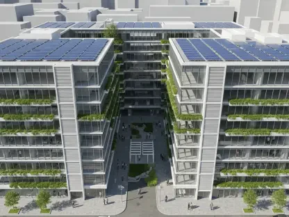
This groundbreaking technology has made its way to construction and location-based services, where commercial enterprises and urban researchers can use it in the current land use occupation crisis. More than 300 urban areas in the U.S. currently have a population count of over 100,000, with New York occupying an estimated 8.3 million and Los Angeles with 3.8 million individuals. To address this growing urban development concern, the U.S. is looking towards investing in green infrastructure, sustainable urban planning, and affordable housing.
Including GEOINT in these initiatives will be the right first step to take in improving population distribution.
GEOINT Transforming Urban Construction and Planning
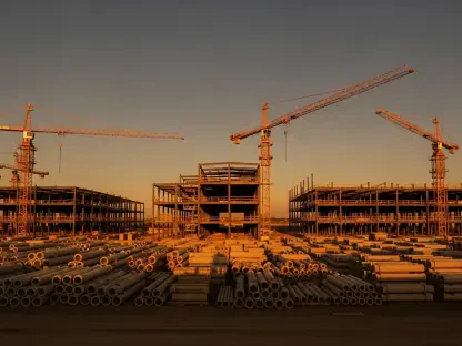
Many constructors know the struggle of ensuring the plans drawn out on blueprints are perfectly replicated in a physical landscape. Any small error in calculation or challenge that arises in the designated land can jeopardize the construction.
GEOINT ensures this doesn’t happen and offers constructors the necessary information to keep them aware of everything regarding the site, from soil type to surrounding buildings and infrastructure, like utility lines. By incorporating this modern tool into urban planning in the early stages of construction, contractors could experience:
Improved site selection.
Fewer delays
Risk reduction
Efficient project management
Optimized resource use
Real-time construction progress.
Regulatory compliance.
When used in construction, GEOINT has the power to remove guesswork, human error, and uncertainty. It provides both designers and contractors with a live view of the land above and below, and how it will change with time. This gives professionals an early start in seeing possible problems before they occur, leveraging the opportunity to change course and adjust designs for the most favorable building outcome.
How Geo-Intelligence Improves Traditional Solutions
The traditional method of construction planning often relies on outdated information from maps, topographic data, and local knowledge for site analysis. As reliant as this method is, it’s a solution that requires manual checking and hinders decision-making speed and logistics planning.
GEOINT automatically addresses these problems at a faster rate and offers real-time data and spatial analyses to support findings and ensure professionals receive up-to-date and accurate information. This assists in finding the best outcome for built infrastructure, ensuring cities’ development plans align with real data for the present that accounts for future landscape changes.
Advanced solutions GEOINT offers for climate change, population growth, and resource scarcity in urban planning include:
3D visualization
Enables planners to see urban environments in three dimensions. This comes in handy during the final stage of urban planning, supporting informed decisions on zoning, building design, and land use planning.
Dynamic infrastructure mapping and monitoring
By using data gathered from satellite imagery, aerial photos, and IoT sensors, GEOINT can create adaptive maps of urban infrastructure in real time. This allows engineers and constructors to identify aging or deteriorating infrastructure, enabling the team to see approaching issues and predict maintenance solutions before they lay down the foundation.
Geospatial artificial intelligence
Urban planners can combine GEOINT and AI to assess how to use the land properly. This is an improved method for zoning maps that combines social, environmental, and economic impact. AI offers insight using satellite imagery and ML to detect unauthorized construction, ensuring compliance before site operations.
Urban expansion forecasting
Uses historical growth data and predictive modeling to project future urban events. This can assist planners when choosing locations to develop, providing ample time to change course and find an alternative that would be more favorable to the operation.
In addition to the thorough analyses it provides, users can also benefit from receiving immediate clarity with real-time reporting, ensuring every person on site is well-informed and updated, leaving no space for misunderstanding or errors.
Conclusion
An increased number of civilians are moving to city centers, leaving urban planners to face the growing challenge of mitigating dense population in one area. Ensuring sustainable development starts in the planning phase, GEOINT is the perfect asset for forward-thinking organizations seeking sustainability in construction. By offering an immediate, data-driven view of the physical world, GEOINT ensures construction businesses can see their blueprint designs come to life before they start a project. This empowers stakeholders to make faster, smarter, and more strategic decisions in expansion initiatives. Additionally, as expensive as construction projects might be, leveraging Geospatial intelligence can cut costs exponentially by avoiding delays, rebuilding, and compliance fines.
This technology offers organizations reduced construction delays, improved safety, smarter site selection, and increased cost savings. Predictive planning tools such as GEOINT give organizations the complete picture needed for future urban development planning.