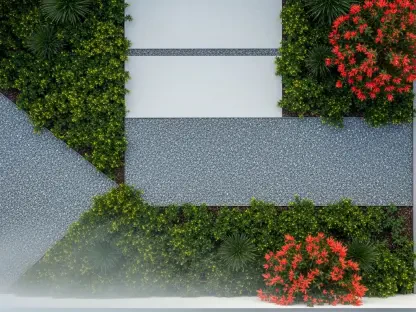

The complexity of modern urban design requires a level of precision that traditional architectural software often fails to provide during the critical early stages of a project. At SERA Architects, a leading West Coast firm known for its commitment to sustainable urban design, the challenge of managing large-scale master planning projects has historically involved a complex dance between several different software platforms. This fragmented approach often led to data silos where critical information regarding floor areas, unit counts, and site constraints lived in isolated spreadsheets rather than the 3D models themselves. By integrating Arcol into their standard operating procedures, the firm has effectively bridged this gap, moving toward a more cohesive and data-driven design philosophy. This transition represents a significant shift in how urban environments are envisioned, allowing for a more fluid exchange of ideas without the technical friction that once plagued the industry. As the demand for rapid, accurate site analysis grows, the adoption of cloud-native BIM solutions has become a competitive necessity.
Overcoming the Limitations of Legacy Systems
Historically, the workflow for a major urban design project required architects to jump between SketchUp for rapid massing, Rhino for complex geometry, and eventually Revit for production, with Excel serving as the manual bridge for data tracking. This methodology created a precarious environment where any change in the physical model necessitated a tedious manual update of secondary documents, increasing the risk of human error and version control conflicts. Designers often spent more time reconciling numbers than actually designing spaces, a reality that hindered the iterative nature of master planning. Furthermore, the “single-file ownership” model of legacy software meant that only one person could work on a specific file at a time, creating bottlenecks that delayed the delivery of critical project milestones. These inefficiencies were not merely inconveniences; they represented a significant overhead cost that limited the firm’s ability to explore a wide range of design alternatives for their developer clients.
The introduction of Arcol’s cloud-native architecture has radically altered this dynamic by centralizing both geometry and metadata within a single, accessible environment. Instead of maintaining disconnected spreadsheets, architects now benefit from automated yield calculations that update in real time as the building masses are adjusted within the browser-based platform. This integration ensures that every design decision is immediately validated against project requirements, such as density targets or zoning setbacks, allowing the team to maintain a high level of accuracy from the very first sketch. Building on this foundation, the platform eliminates the need for constant file synchronization or the complex management of central models that typically characterizes traditional BIM software. By moving the entire design process to a high-performance web interface, the firm has removed the hardware barriers that often restricted collaboration, enabling a more inclusive and responsive design environment that caters to the fast-paced nature of modern urban development projects.
Facilitating High-Stakes Collaborative Design
During a recent 80-acre mixed-use development project, the advantages of a “multiplayer” design environment became strikingly clear as four designers collaborated simultaneously within the same digital workspace. Unlike traditional systems where users must check out worksets or wait for others to sync their changes, Arcol allowed for instantaneous updates that were visible to the entire team across different geographic locations. This level of transparency facilitated a parallel exploration of various design scenarios, such as testing different park configurations or residential orientations, without the fear of overwriting a colleague’s work. This collaborative agility proved essential when dealing with high-stakes projects where site conditions and program requirements can shift rapidly based on stakeholder feedback. The ability to work in tandem not only shortened the overall production schedule but also fostered a more holistic approach to placemaking, as designers could see how their individual contributions affected the broader urban fabric in real time, leading to more cohesive outcomes.
The evolution of the presentation process further demonstrated how these technological advancements transformed the relationship between architects and their clients through enhanced transparency. Rather than delivering static PDF decks, the design team utilized live browser links that enabled developers to interact with the model directly and leave contextual comments within the digital environment. This interactive feedback loop allowed the firm to make live adjustments during review sessions, providing immediate data-driven insights into how specific changes influenced the project’s bottom line. Ultimately, the adoption of these modern tools enabled a shift away from manual documentation toward a more strategic focus on creative problem-solving and environmental impact. The firm successfully demonstrated that integrating real-time collaboration and automated analytics was the most effective path forward for complex urban design. Industry professionals should consider similar transitions to cloud-native platforms to ensure that project delivery remained both efficient and highly responsive to the evolving needs of the global marketplace.