
Luca Calarailli is a seasoned veteran in the construction industry, renowned for his deep expertise in architectural design and his relentless pursuit of technological innovation. With a career built on navigating the complexities of high-stakes projects, he has become a leading voice in how digital tools can transform compliance from a bureaucratic hurdle into a streamlined design advantage. His passion lies in bridging the gap between traditional architectural craftsmanship and the rapid evolution of building information modeling (BIM), ensuring that safety and precision remain at the forefront of modern development. Today, we explore how the integration of advanced scanning solutions is redefining the standards for architectural practices working in heavily regulated environments.
The conversation covers the strategic importance of maintaining a “golden thread” of information for safety compliance and the technical shift from manual surveying to automated LiDAR-to-Revit workflows. Calarailli also delves into the nuances of risk management for lead consultants in high-risk sectors like nuclear and defense, the practical benefits of deploying sophisticated technology across diverse staff levels, and his long-term outlook on the role of digital records in the future of the industry.
Managing a “golden thread” of building information is vital for compliance with modern safety standards. How does real-time digital scanning help maintain this data continuity, and what are the primary challenges when integrating these precise data sets into long-term safety records?
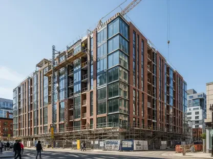
In the current regulatory climate, particularly with the demands of the Building Safety Act, the “golden thread” is no longer an aspiration but a strict requirement for high-risk developments. Real-time digital scanning allows a team of 100 architectural professionals to capture the exact state of a building at any given moment, ensuring that the digital model is a living, breathing reflection of the physical site. This technology generates exceptionally detailed point cloud data within minutes, providing a factual foundation that eliminates the guesswork often found in legacy paperwork. The primary challenge lies in the sheer volume of information; integrating these precise data sets requires a robust software platform that can translate raw points into actionable Revit-ready models without losing the granularity needed for long-term safety records. By establishing this high-accuracy baseline early on, we can ensure that every subsequent modification is documented with the level of rigor demanded by modern safety regulations.
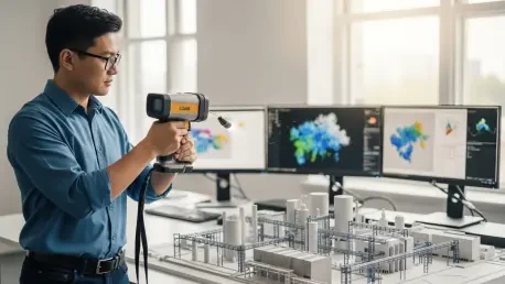
Surveying existing or partially demolished buildings is traditionally a slow and expensive process for architectural practices. What specific steps are involved in converting LiDAR point cloud data into Revit-ready models, and how do these automated workflows reduce the margin of error compared to manual methods?
The traditional method of surveying often feels like a race against time and budget, involving manual measurements that are prone to human oversight, but LiDAR technology has completely flipped that script. The process begins with a rapid scan that captures millions of data points, which are then processed through specialized software to produce an outline model that is immediately ready for Revit. This workflow allows us to correct and enhance existing survey and planning information on the fly, transforming what used to be a weeks-long ordeal into a matter of minutes. Because the system captures the environment exactly as it exists—including the skeletal remains of part-demolished structures—the margin of error is drastically reduced compared to a surveyor with a tape measure or a laser rangefinder. These automated workflows provide a level of coordination and assurance that simply wasn’t possible with manual methods, allowing our designers to focus on creative problem-solving rather than verifying dimensions.
Architects often assume significant liability when acting as lead consultants on complex nuclear or defense projects. How does having access to high-accuracy site data influence your risk management strategy, and in what ways does it strengthen the assurance of your professional indemnity insurance?
When you are operating in sectors as sensitive as nuclear and defense, the weight of professional indemnity insurance is always at the back of your mind because you are often assuming full liability. Access to high-accuracy site data is the ultimate shield in our risk management strategy; it provides an indisputable record of the “as-built” conditions, which is crucial when performing Principal Designer or Clerk of Works duties. By using LiDAR BIM scanning, we can identify potential clashes or structural discrepancies before they become million-dollar liabilities on the construction site. This level of precision provides a massive boost to our professional assurance, as we can demonstrate to insurers and clients alike that our designs are based on verified, real-world data rather than outdated blueprints. It effectively removes the “uncertainty tax” that usually plagues complex projects, allowing us to deliver coordinated design information with absolute confidence.
Deploying new scanning technology across various staff levels requires consistent results to be effective. How do you ensure data accuracy when correcting outdated planning information, and what measurable gains have you observed regarding project coordination and overall design speed?
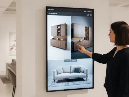
The beauty of modern LiDAR solutions is their accessibility; we have successfully deployed this technology across five separate buildings with staff at all levels, from junior designers to senior associates. To ensure accuracy, the software platform validates the point cloud data against existing records, highlighting where outdated planning information needs to be corrected or enhanced. We have observed measurable gains in both speed and cost savings, as the ability to generate Revit-ready models in minutes significantly accelerates the entire design workflow. Coordination becomes much more intuitive when everyone is working from the same high-fidelity digital twin, reducing the need for repeated site visits and “stop-and-fix” sessions during the construction phase. This collective ease of use ensures that high-quality data becomes a standard part of our output, rather than a specialized task reserved for a few tech experts.
What is your forecast for the role of LiDAR technology in architectural compliance over the next decade?
Over the next ten years, I forecast that LiDAR technology will transition from a competitive advantage to a mandatory regulatory requirement for all architectural practices. As digital record-keeping and safety assurance requirements continue to intensify, the industry will move toward a “scan-to-comply” model where real-time data capture is integrated into every stage of a building’s lifecycle. We will likely see these scanners becoming as common as the smartphone in a designer’s pocket, used not just for initial surveys but for continuous verification during construction to maintain the “golden thread” without any breaks. Ultimately, this will lead to a safer, more transparent built environment where the gap between the architect’s vision and the final structure is virtually non-existent, underpinned by a flawless digital trail.