As technological advancements increasingly shape various sectors, the integration of Geographic Information Systems (GIS) and Building Information Modeling (BIM) into emergency response strategies has gained momentum. These tools are revolutionizing how emergencies are managed, promising enhanced efficiency and accuracy in critical times. The collaboration of these technologies brings forth new solutions, optimizing real-time data use and transforming vital industry practices. A notable example is showcased in Washington D.C., where firefighter Jeffrey Lenard and GIS analyst Tim Hutchison utilized GIS data to develop an innovative maritime tool. This tool improves emergency response by enabling responders to access real-time information, ultimately leading to better-informed decisions and swifter actions.
The Transformative Role of GIS
Geographic Information Systems have long been integral to emergency management, offering spatial analysis and data visualization vital for informed decision-making. In recent developments, GIS has expanded its role, bridging gaps with technology like real-time data transmission and mobile mapping. These advancements enable responders to quickly access crucial information, ensuring response actions are efficient and effective. Washington D.C.’s initiative in maritime emergency response exemplifies this progress by using GIS data to fill operational gaps, showing how spatial awareness can drastically improve situational understanding.
The benefits of GIS are not limited to immediate emergency response. The technology also plays a significant role in planning and risk assessment. By analyzing patterns and potential risks geographically, stakeholders can develop more comprehensive emergency preparedness plans. These capabilities allow for targeted training and resource allocation, ultimately enhancing overall resilience. As GIS continues to evolve, its application in emergency management is set to expand further, bringing new innovations and improvements to the forefront of disaster response strategies.
BIM’s Rising Influence in Emergency Management
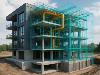
Building Information Modeling (BIM) is increasingly influential in emergency management, providing detailed digital representations of physical spaces. This technology aids in pre-planning by enabling precise simulations of various scenarios, helping responders anticipate challenges and devise strategies accordingly. BIM also facilitates collaboration among different agencies by providing a unified platform for sharing crucial building information. In disaster scenarios, BIM models can offer a detailed view of structures, helping responders navigate and manage resources more effectively. As BIM technology progresses, its integration into emergency management strategies is expected to bring even more transformative benefits, enhancing the overall efficacy of disaster response efforts.


