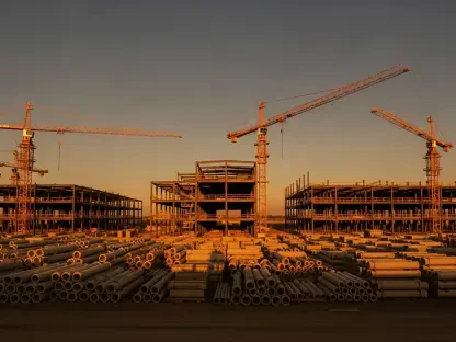

Hyderabad stands at a critical juncture, with its ambitious vision of becoming a sprawling megapolis clashing with the stark reality of an ever-widening infrastructure deficit. Urban planning experts warn that the government’s rapid territorial expansion, designed to accommodate explosive growth, is dangerously outpacing the development of essential civic services. The consensus among planners is that without a massive, coordinated, and immediate investment in foundational amenities, the dream of a world-class city could devolve into a nightmare of unplanned, inequitable, and unsustainable urban sprawl. This rapid, unchecked growth threatens to create a fragmented landscape of underserved communities, a stark contrast to the integrated and thriving metropolis envisioned by policymakers. The challenge is not merely about managing growth but about preemptively building the capacity to support a megapolis before it materializes, a task that requires immense foresight, capital, and political will to execute effectively and on an unprecedented scale.
The Scale of Unchecked Expansion
The government has aggressively pushed the city’s boundaries outward, enlarging the Hyderabad Metropolitan Development Authority (HMDA) jurisdiction from approximately 7,200 square kilometers to over 10,400 square kilometers, a move that redefines the city’s geographical footprint. A similarly vast expansion is proposed for the Greater Hyderabad Municipal Corporation (GHMC), which is set to grow from 650 square kilometers to nearly 2,000 square kilometers by merging with surrounding municipalities. This monumental territorial expansion is projected to result in the Hyderabad Metropolitan Region (HMR) housing nearly half of Telangana’s entire population in the coming decades. This growth is not a distant forecast but a present reality, catalyzed by major infrastructure projects like the Regional Ring Road (RRR), which are acting as magnets for development. The speed and scale of this expansion place immense pressure on planners to ensure that the city grows in a structured, sustainable manner, rather than simply sprawling outwards without a coherent plan for services and livability.
This accelerated growth is already creating significant problems on the ground, serving as a cautionary tale for the future. In the vast expanse of land between the existing Outer Ring Road (ORR) and the proposed Regional Ring Road (RRR), hundreds of new residential colonies have emerged, many in a regulatory gray zone. These developments frequently lack the most fundamental amenities, including properly paved roads, functional sewage systems, and a reliable, piped water supply. This trend exemplifies the primary risk highlighted by urban planners: expansion without a parallel investment in infrastructure does not create a sustainable megapolis but rather a disconnected patchwork of underserved communities. Experts estimate that rectifying this existing deficit and providing reliable, modern infrastructure to these newly populated areas would require a minimum of a decade of focused, efficient execution. This timeline underscores the urgent need for a proactive strategy that builds infrastructure ahead of, or at least concurrently with, residential and commercial development to avoid entrenching inequality and dysfunction.
The Looming Infrastructure Crisis
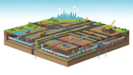
Experts pinpoint several monumental challenges that threaten to derail Hyderabad’s progress, with solid waste management emerging as a particularly acute concern. The GHMC currently handles about 5,500 tonnes of garbage daily, with the wider Greater Hyderabad region generating around 8,000 tonnes. Following the proposed municipal mergers, this volume is projected to surge past 10,000 tonnes per day. This dramatic increase would completely overwhelm the current system, which relies heavily on the already strained Jawahar Nagar dumping yard. Officials concede that a significant expansion of collection, transportation, and processing facilities is an unavoidable necessity. Equally daunting is the challenge of providing sewerage infrastructure. The scale of the required investment is staggering, with experts estimating a need for approximately 4,500 kilometers of new sewer lines for the expanded GHMC limits alone. This undertaking, which includes the construction of new trunk mains and sewage treatment plants (STPs), is projected to cost around ₹20,000 crore, a figure that highlights the immense capital needed to prevent a public health and environmental crisis.
Water supply represents another critical pressure point in the city’s rapid urbanization. While Hyderabad’s current supply of 550 million gallons per day (MGD) adequately serves the existing GHMC limits, the newly merged areas will demand an additional 150 MGD. This increased demand will place immense strain on existing water sources, such as the Krishna and Godavari rivers, as well as the entire distribution network. Planners emphasize that simply expanding the supply is insufficient; the city’s aging infrastructure, including decades-old pipelines and pumping stations, must be modernized simultaneously to handle the increased load and prevent catastrophic failures. Failing to do so, they warn, will likely result in a system of inequitable water access, where core urban areas receive consistent service while peripheral zones experience frequent and severe shortages. This scenario would not only hinder the quality of life for millions of new residents but also undermine the economic potential of these emerging growth corridors, creating a city of haves and have-nots defined by access to a basic necessity.
A Strategic Path Forward
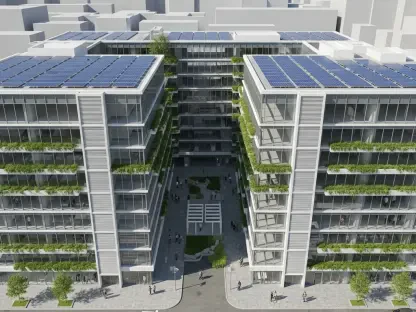
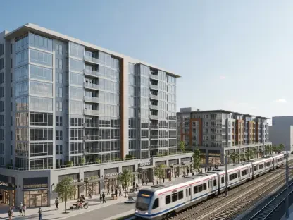
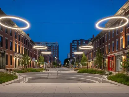
To counter these formidable challenges and guide growth constructively, experts strongly advocate for the widespread adoption of a transit-oriented development (TOD) model. This urban planning strategy aims to prevent the crippling congestion and inefficiency associated with sprawl by concentrating future development in high-density, mixed-use, and walkable neighborhoods. These hubs would be strategically situated within a 15 to 30-minute radius of mass transit stations, integrating residential, commercial, and recreational spaces. The key components of this model for Hyderabad include a significant extension of the metro rail network, strengthening the Multi-Modal Transport System (MMTS) and suburban rail systems, developing a comprehensive network of radial roads connecting the core to the periphery, and ensuring robust last-mile connectivity through buses, ride-sharing, and cycling infrastructure. By making public transport the most convenient option, the TOD model can reduce dependency on private vehicles, lower carbon emissions, and foster a more vibrant and equitable urban environment for all residents.
When considering this model, planners reference the development of satellite cities like Gurugram and Noida around Delhi as partial precedents but include a critical cautionary note. Hyderabad must learn from their mistakes to avoid repeating them. A primary failure in those cases was the lack of adequate and timely public transport integration, which led to automobile dependency from the outset and resulted in legendary traffic congestion and poor air quality. Furthermore, an uneven distribution of infrastructure created pockets of high-quality living surrounded by areas with inadequate services, exacerbating social and economic inequality. For Hyderabad to succeed where others have struggled, it must ensure that high-capacity transit and core civic amenities are planned and implemented as the foundational framework for its satellite cities, not as an afterthought. This proactive approach is essential to building truly sustainable communities rather than just sprawling suburbs that replicate the problems of the core city on a larger scale.
The 2047 Vision and Its Demands
All these efforts are framed within the state’s ambitious “Telangana Rising 2047” vision, a long-term strategic plan to elevate Hyderabad into a $600 billion city economy and rank it among the world’s most livable urban centers by 2047. This vision prioritizes several key areas critical for sustainable growth, including the promotion of clean mobility through electric vehicles and expanded public transport, the comprehensive development of underground cabling for power and communications to create clutter-free and resilient streetscapes, the rejuvenation of the city’s historic rivers and lakes, and the creation of climate-resilient infrastructure capable of withstanding extreme weather events. Experts view this vision as both ambitious and achievable, but only on the strict condition that meticulous planning is matched by rigorous, disciplined, and timely execution. The gap between a visionary blueprint and a functional reality can only be bridged by a sustained commitment to on-the-ground implementation and the political will to overcome bureaucratic and financial hurdles.
The government’s strategy partially aligns with expert advice, envisioning the creation of self-sufficient satellite cities at key nodes along major highways, with projects like the proposed Future City intended to foster a mix of industrial, residential, and commercial activities. However, experts stress that for these satellite cities to be successful and sustainable, their development must be guided by a focus on comprehensive social infrastructure—including high-quality schools, hospitals, parks, and public spaces—rather than being driven purely by real estate speculation. To prevent chaotic, developer-led growth, it will be crucial to implement effective policy tools. These include efficient land pooling mechanisms to assemble parcels for planned development, strict zoning regulations to ensure a healthy mix of uses and protect green spaces, and the establishment of a dedicated urban infrastructure fund to finance the upfront costs of essential services. Without these governing frameworks, the satellite cities risk becoming isolated enclaves that fail to integrate into the larger metropolitan fabric.
A Future Defined by Foundational Work
Hyderabad’s transformation into a well-planned, globally competitive megapolis was ultimately not a foregone conclusion based on expanding its boundaries or announcing mega projects. Its future was decisively shaped by the practical, on-the-ground implementation of the basic infrastructure that forms the bedrock of any great city. The expert consensus was clear: without a sustained, coordinated, and proactive focus on building the foundational networks for water, sewage, waste management, and transport ahead of population growth, Hyderabad had risked creating a dysfunctional and fragmented urban environment. The challenge was immense, but it also presented a unique opportunity. With the right strategic investments, meticulous planning, and unwavering execution, the city possessed the potential not only to achieve its ambitious goals but also to become a model of sustainable and equitable urban development for the rest of India.